As we were on the last leg of our journey I must acknowledge one thing that one should visit this distant land at least once in the lifetime. Everything in this corner of the world seems heavenly, crafted by the god himself! A special mention has to be made for people living in these areas. They live a tough, very basic life yet are always eager to help the needy. Their ever smiling faces always touch you from within.
The last day at Kaza was probably the best throughout the journey. If you had missed that journey then here is the link.
https://wayfarerscorner.com/2017/10/14/305/
After traveling to the highest village in the world I thought the drive to Manali (203 km) will be a bit easier. It turned out to be far from the truth. We went for a bit of shopping in the last evening at Kaza. The market was small but all necessary items like food, clothing, medicines etc were available. We purchased few food items for next day’s journey as the route has only a few eateries available and that too quite far from each other. Our car was also topped up at the world’s highest petrol pump at Kaza as the next fuel station was only available in Manali.

After that, we were back at our guest house and did usual things like having tea-coffee etc then discussing the trip so far and then had dinner. One thing I want to mention here that Kaza and its adjoining areas like Tabo, Nako etc are known for photographing star trails. The sky in this part of the country is so clear that you can literally see millions of stars clearly from any place here even with necked eyes, a thing most of us from cities could not even imagine due to excessive use of artificial lights and pollution. I had been trying to photograph star trails for last three or four days in this trip but because of windy and cloudy conditions I could not be able to do the same. The last evening was better but still not good enough for shooting star trails; well I promptly added it to my bucket list!
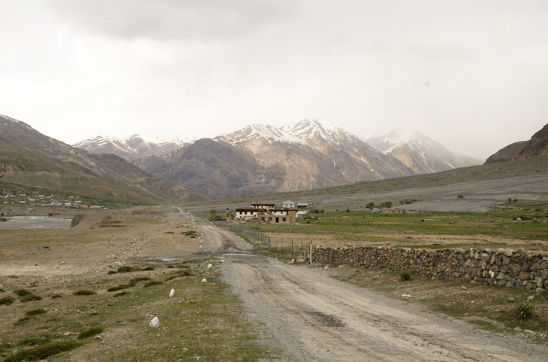
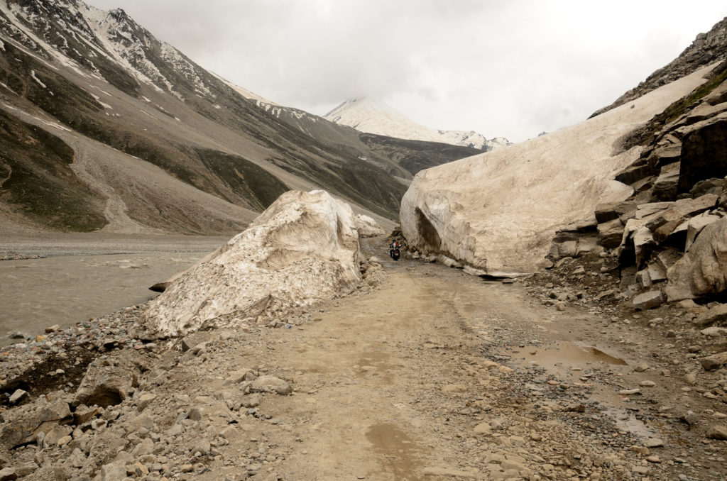
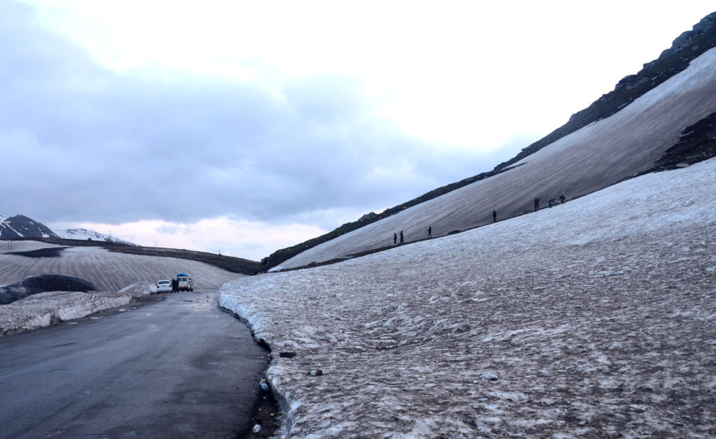
The next morning for the first time we started as per our plan. After leaving the guest house we stopped at a place for quick breakfast. Then we crossed the famous iron bridge to cross the Spiti river, now the river was at our right. The views were just amazing, the famous Kye Monastery could also be seen from this road and it was as beautiful as it was from the other side of the river. Initially, road conditions were good though the roads were narrow. We felt relieved but it was too early. Just after Pangmo (28 km), the road conditions started deteriorating and it only worsened with time. After some time there were literally no roads only gravels. These roads remain snow covered for the better part of the year and this year roads were cleared for regular vehicular traffic only in the first week of June. So it could be safely concluded that roads were snow covered even 15 days back. Naturally, it took its toll and roads and adjoining mountains were still highly unstable. The result was obvious; the drive was like participating in an off-road car rally! Slowly we inched forward to Losar, a picturesque village at the end of Spiti. Of late this place has become popular among trekkers and photographers. We did not stop at this village but just passed through it. One thing is sure that you just cannot visit everywhere in just one trip, the place is so vast and mind-blowing that you want to come back here again and again!
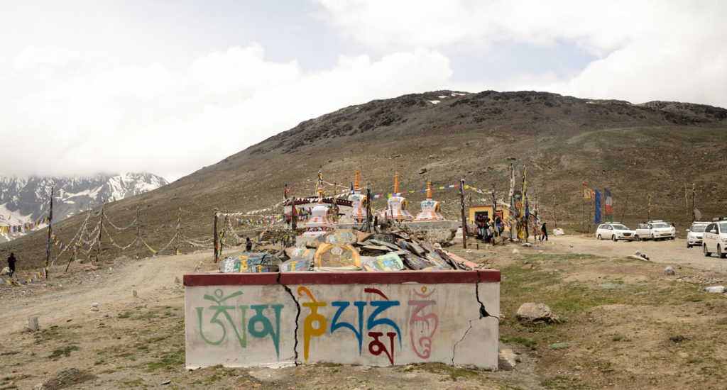
The road which was somewhat flat till Losar started to move upwards after Losar. The bad roads up there coupled with breathtaking views thus presenting a rare contrast. One hour from Losar, Kunzum La or Pass (4590 meters of 15,060 ft) one of many high passes in the Himalayas was waiting for us to welcome. It was also the highest point between Kaza and Manali. But reaching there was not without challenges. Finally, we reached Kunzum top which was surrounded by beautiful snowcapped mountains and glaciers. A beautiful Buddhist stupa with colourful prayer flags hanging from its top was making the place surreal. As per the local custom every vehicle passes through the Kunzum pass should drive around this stupa, some stop there to offer prayers and others stop to soak in the beautiful surrounding while others try to capture the beauty of this place in the memory cards of their smartphones and cameras, even though spending more time at Kunzum top is not advisable because of AMS (Acute Mountain Sickness).
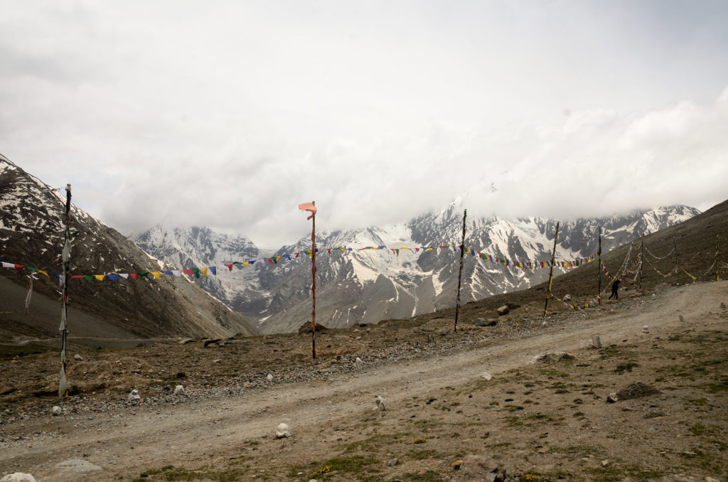
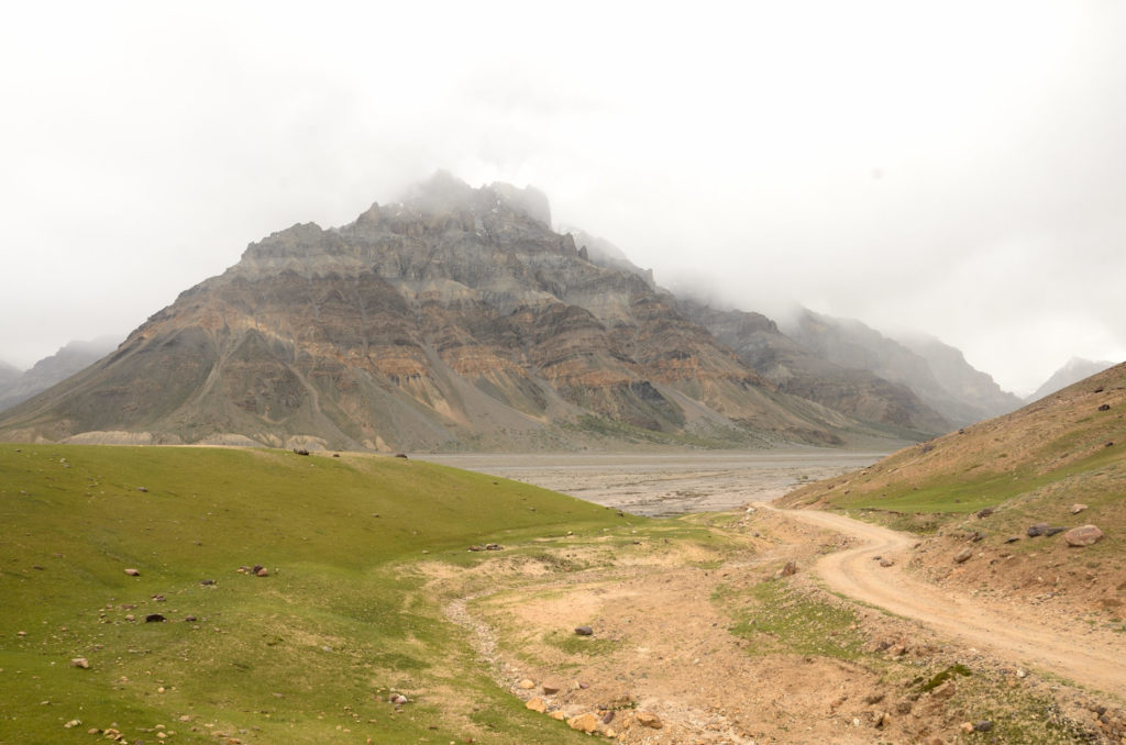
After the Kunzum top, it was all downward journey but it was not easy at all. In fact, real adventure started after passing the Kunzum top which we realized later. The road had many water crossings which made the conditions terrible. Our speed reduced further even though we were coming down. The water seeping from the hardened snow from the last winter made the road very slippery. It was a real test for both the man and the machine. We reached Batal, a tiny hamlet 13 km from it after a struggling one hour or so drive through the distance is only 9 km from the Kunzum top.
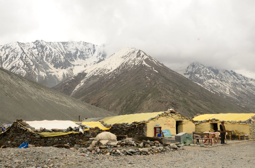
From Batal the famous Chandra Taal or Moon lake is only 14 km of which last 5 km or so has to be covered by foot. It was on our original itinerary but we dropped it as we still needed to cover a lot of distance to reach Manali. Batal is the only place on this route where you can get something to eat from the two eateries available here. It was great to see some signs of civilization after hours of bumpy drive. We had tea and some parathas from the famous Chacha-Chachi Dhaba at Batal. The eateries here double as places to halt at night for those who could not reach the nearest settlement on either side of the Kunzum pass. The place was cold and extremely windy. From here onwards it was very difficult to differentiate between the road and riverbed. From Batal the river Chandra, which derives its name from Chandratal Lake was our companion till Tandi where Bhaga river joins it from the east and then the river is called Chandrabhaga. The Chandrabhaga river is also known as Chenav river and is a major tributary of the Indus river.
With the hardened snow still present on the roadside and numerous glacial streams eager to meet the river on our left our vehicle, getting tested by every loose gravels on the road, sometimes even hitting the bottom of the vehicle we reached Chatru around 4 pm. The difficulty of this terrain can be gauged by the fact that it took us around 4 hours to reach Chatru from Batal, a distance of mere 31 km.
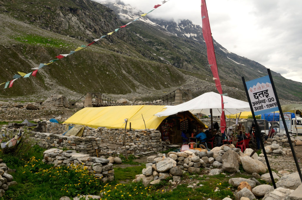
After this tough drive to Chatru, we got the glimpse of a restaurant just on the bank of the river, we felt extremely delighted just by the sight of this after this tedious journey. We were very hungry and had our late lunch of steaming hot Maggie with hot coffee at this small joint. Like the restaurant at Batal, this place also offers some places to spend the night, mostly in tents, for the travelers in need. The owner of the joint informed that the road till Gramphu, 17 km from Chatru is same or worse and we need to pass it as quickly as possible. But we were already late even after starting early from Kaza. As a matter of fact all water crossings on the roads in the Himalayan region is direct result of melting of ice from the glaciers, thus gain volume as the day progresses due to sunlight and the evening time especially from 4 pm onwards the volume of water reaches to its maximum, making these tough roads even tougher to travel. We had no option but to take this route. The road was just in the name, it was just loose stones pressed hard by BRO workers to make it somewhat drivable. We reached Gramphu after 2 hours of difficult yet picturesque drive. In one of the water crossings, our vehicle hit a big boulder and thus damaged the front bumper a bit. Only after reaching Gramphu we felt little assured though roads were still bad, the worst was over by then.
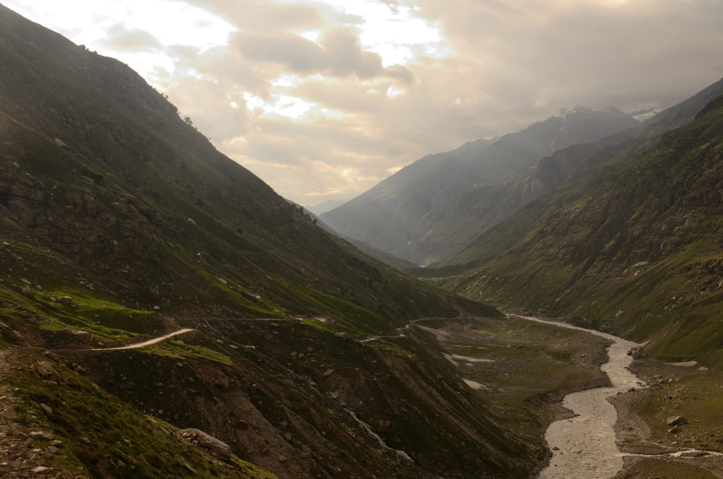
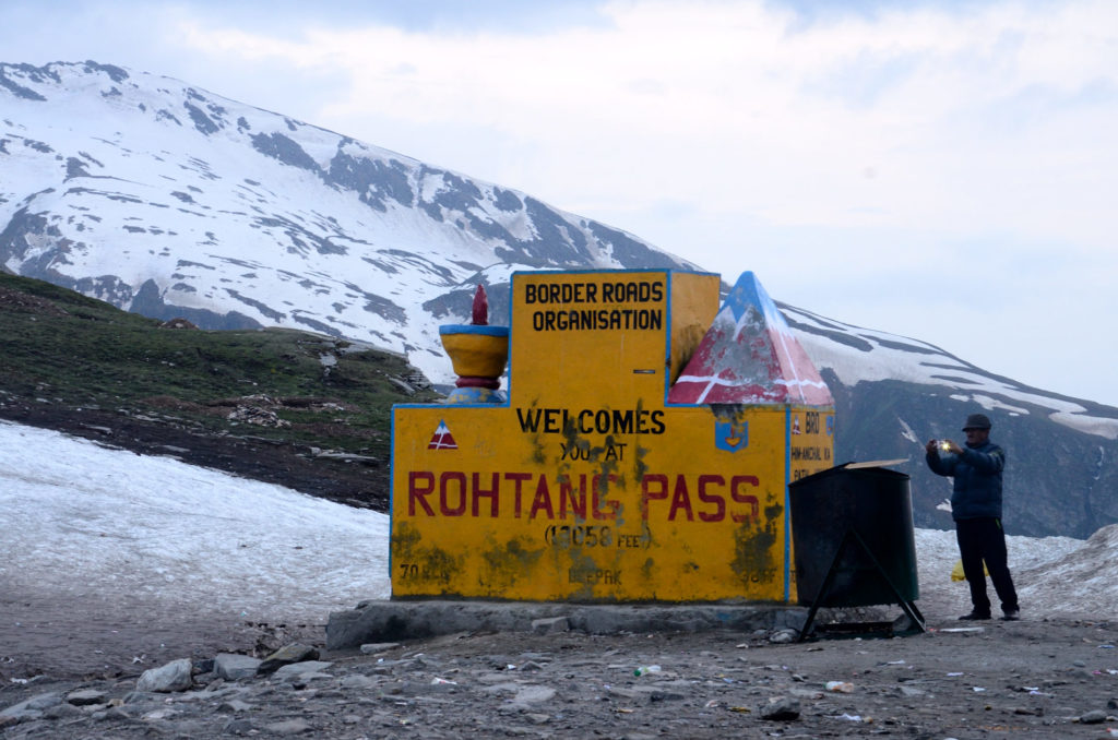
It took us around 1 hour to reach famous Rohtang La or Pass from Gramphu due to heavy traffic. Almost all the traffic was directed towards Keylong, a place to stop at night for Leh bound travelers. We stopped at Rohtang top (3978 meters or 13,050 ft) for some 15 minutes then continued our journey to Manali 52 km away.
It was around 9.30 in the night when we reached our hotel at Manali. We were very tired so had our dinner very quickly and went straight to bed. We were on road for almost two weeks, though our trip was not yet over completely but the major part for which I have planned for months together if not years was over once we reached Manali and that too without any major issues. This is important when you are traveling in a group. I must say here that coming to this part of the country, meeting local people change you forever in some way or the other. I am definitely going back there again!
Getting there:
By road– Distance between Kaza to Manali is 203 km but it takes a whole day because of extremely bad roads. Starting as early as possible from Kaza is very important.
Stay- Manali is popular among tourists hence it has all kinds of options to stay to suit all budget.
Connectivity- Before Rohtang Pass, there is no connectivity for the most part but connectivity gets better after crossing Rohtang Pass. Manali has very good high speed internet connectivity as well.
Precautions– All areas till Rohtang Pass are at very high altitudes. So take care of yours body and mind. Acute Mountain Sickness (AMS) is very common for non locals/ travelers. Kaza has a big government hospital outside the town that provides medical facilities for the locals as well as tourists. The hospital has proper oxygen supply and the facilities can be used in case of any emergency. Don’t exert yourself. Diamox tablets are good for AMS. Regular water intake is very important to keep the body properly hydrated. The Sunlight during the day time is very harsh so a good sunscreen lotion is very handy; it prevents the body from sunburns.